
Introduction
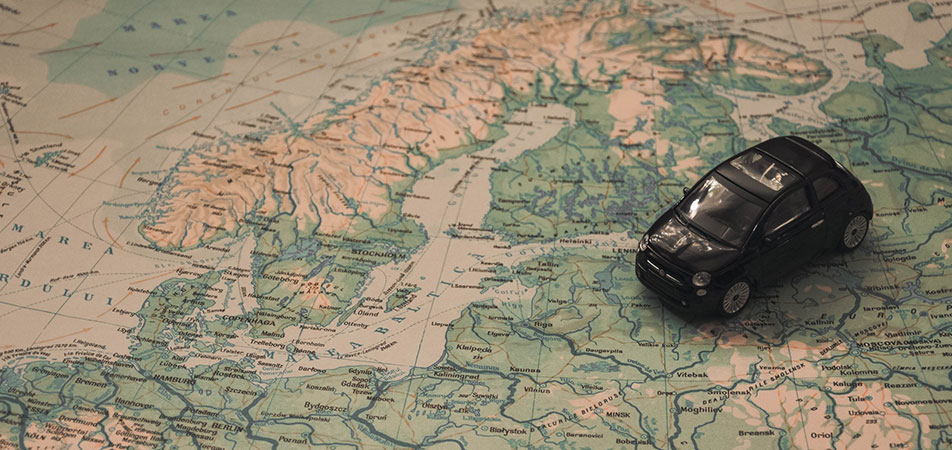
GIS stands for Geographic Information System. Simply put, it’s an information system that help us capture, analyze and present spatial information on a map. Currently, a millions of decisions are made with the help of GIS . As it allows us to make better decisions using geography. Business sector has been benefited the most with the introduction of GIS technologies, as the retailers use to pinpoint the best location to open new stores and stock items that match local customers needs.
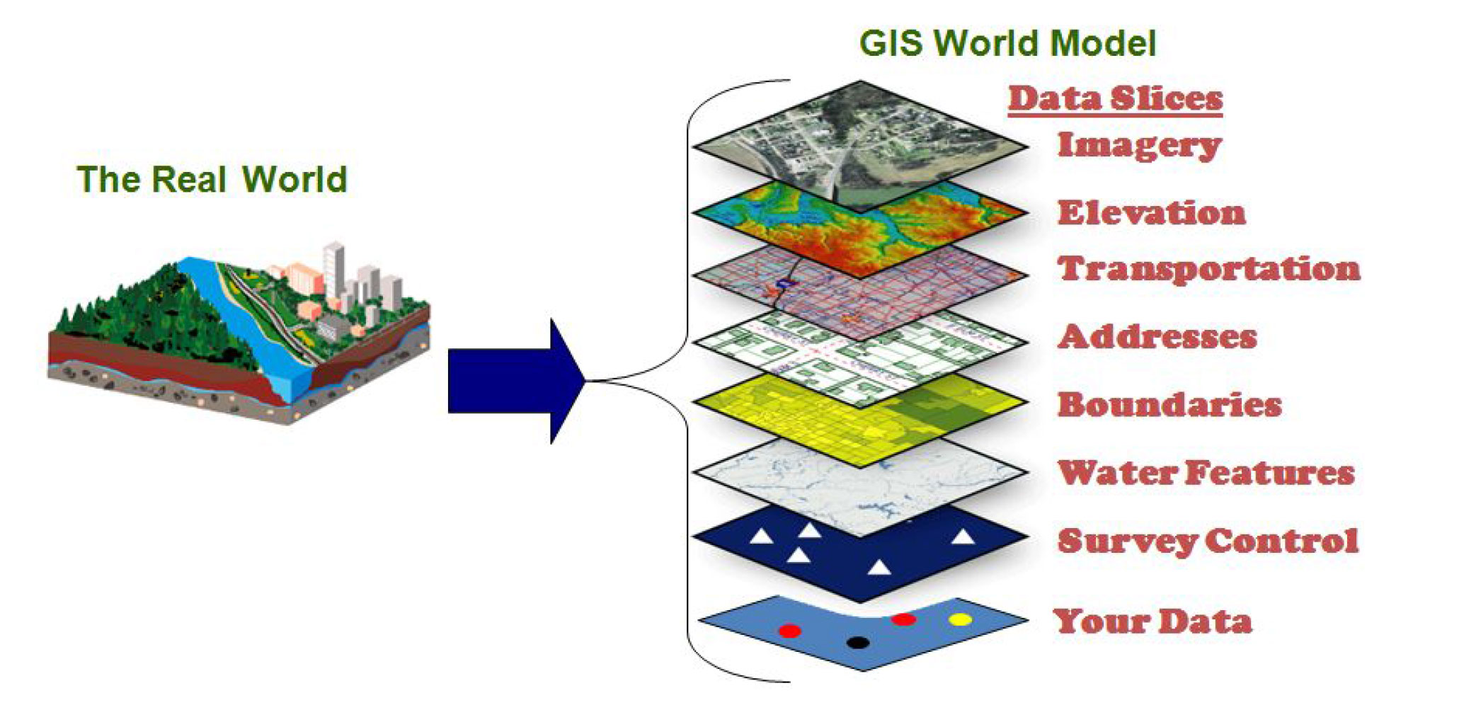
Fig [1.1] : GIS is a way to analyze and present geographical information on a map
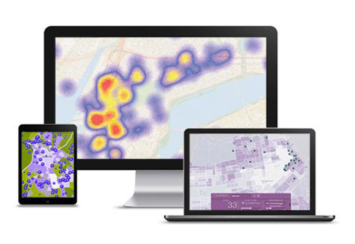
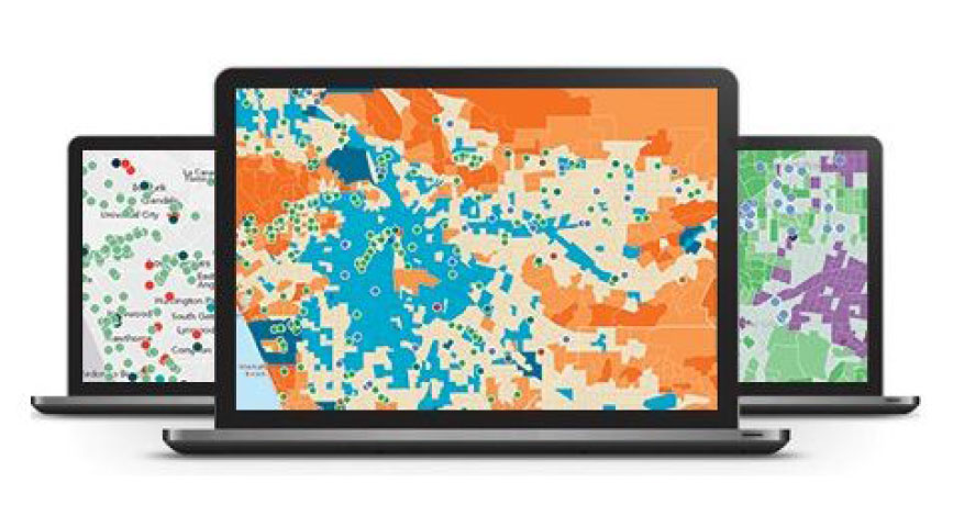
Industries benefited by GIS
Once a treat for the upper classes, video games have become an incredibly technologically advanced piece of equipment to have casually laying around your living room.
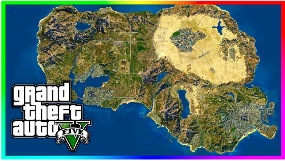 Now, a new avenue has opened up in the world of GIS: video games. What do these two pieces of advanced technology have to do with each other? For starters, many video games are set in virtual worlds that require some knowledge of real-world geography. Games like World of Craft and SimCity are fantasy worlds while games like Call of Duty and Grand Theft Auto emulate real world places like Iraq and California. Keeping these places geographically correct in the game gives players the ability to immerse themselves in the scenario, making it more realistic.
The most trending product to talk about while we discuss GIS and Gaming is surely the biggest hit of the summer – Pokémon Go. The gaming phenomenon has set all kinds of milestones including over 100 million Android downloads its first month. 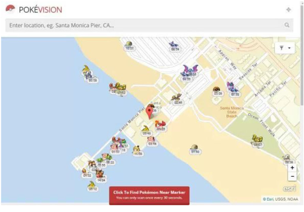 Behind the scenes Pokémon GO is powered by location based services, GIS, and GPS . The combination of geospatial data and augmented reality has made Pokémon Go a massive hit. It leverages enormous amounts of geospatial data about each user’s location. It analyzed this data to identify locations and features in parks, attractions, PokeStops, and PokeGyms. They had to identify accessible places where people would want to go. Pokemon Go would not be as successful as it is without geospatial data.
Pokevision is a new launch that enables users to find Pokemons on the map, it uses map tiles and geocoding services from Esri [6]. It is already the most popular app that uses Esri technology. The game encourages users to explore the cities and towns where they live to capture. PokéStops are located at places such as public art installations, trails, and historical markers and monuments.
Marketing
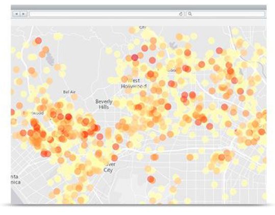
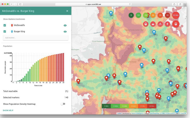
Location is the key to successful development, evolution, and growth of the marketing strategy. From social media to display advertising, coupon optimization, and sentiment analysis, understanding place gives a better view of what’s what and who’s where. GIS based location analytics can help get a game plan that reduces uncertainty, drives
profitability, and improves performance.
Benefits of using GIS based solutions: 

- Optimize Sharpen the store network. Provide the best service to the customers as efficiently as possible.
- MaximizeIncrease sales from every outlet. Understand who the customers are and how to
attract more like them. - ImproveCreate enviable marketing outreach. Big or small, local or global, put place back into the mix of price, place, and promotion.
Solutions based on GIS available for the industry:
Esri Location Analytics
 The connected consumer is changing the face of business. To make the most out of e-marketing and social media strategies without cannibalizing existing brick and mortar stores. Location brings meaning to mobile technology and helps you create a winning bottom line.
ArcGIS Platform
 ArcGIS is the geography platform for the retail organization. Integrate ArcGIS into existing business systems, improving access to information across your organization. Improve business agility while making the best decisions.
Esri Demographics
 Save money by marketing to the right people and knowing where to spend resources to serve those most in need. Gain crucial insights by identifying the best customers and prospects and tapping into the who of lifestyle demography
with the where of location neighborhood geography.
Security & Defence
GIS is useful from securing small mobile devices and vehicles to a large scale national security and defence.
There are numerous products available in market powered by GIS. Including the one used widely for vehicle tracking – “Tracking Genie®: GPS Vehicle Tracking System in India” 
Asset management and protecting misuse of vehicles is one of the key issue for every government department. Tracking Genie is capable to manage hundreds or even thousands of vehicles at same time and empowered with its real time location data along with other important data sets our clients can effectively manage the operations and bring down cost of operations.
Nearly every federal agency depends on geospatial intelligence to meet its mission. With GIS, they increase operational efficiency, track and evaluate activities to meet mandates, and conduct better analysis for informed decision making. Bring data into an enlightening geographic context that delivers transparency and accountability.
Monitoring and analyzing crimes is an essential component in civil administration. The utilities of GIS help in identifying the hotspot area of the crimes and facilitate the development of investigation for police which is integrated with sociology-economic attributes.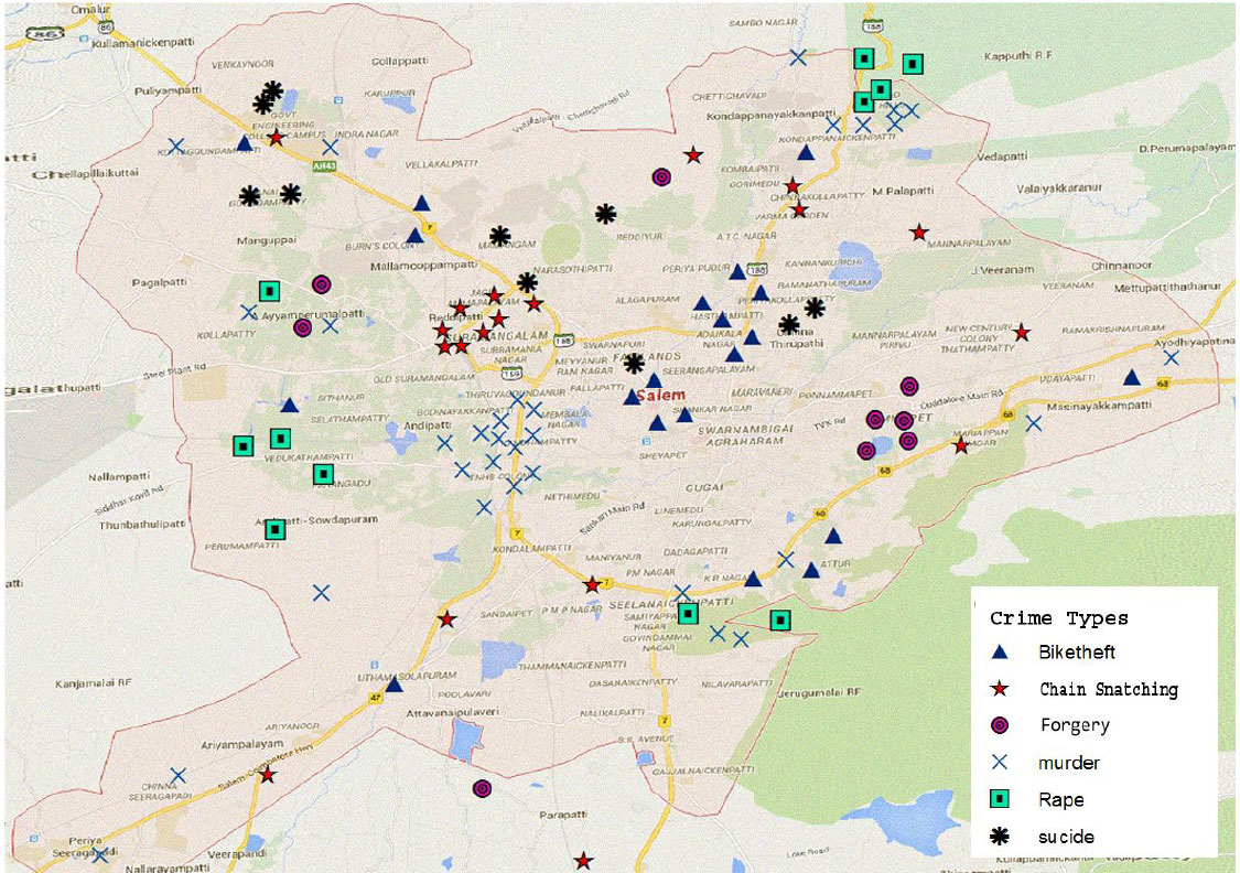 The crime data are shown in map format which enables the
user for quick view of crime spot. The above profile can be linked with GIS for enhancing complete safety to the society. Map of Salem district is taken and various information such as taluks, municipalities, police station, hospitals, schools, colleges, urban areas, industries, public buildings etc.. are shown in map format using GIS which can enhance the clear profile about the district. Separate map is shown using crime historical data.
Travel & Transport
Since transportation is inherently a spatial activity, GIS is particularly well suited to be a platform for managing much of the data used in transportation applications. From the past few years GIS have moved from the mainframe environment to the desktop of the transportation professional.
GIS can be used in managing transportation and logistical problems. If transport department is planning for a new railway or a road route then this can be performed by adding environmental and topographical data into the GIS platform. This will easily output the best route like flattest route, least damage to habitats and least disturbance from local people. GIS can also help in monitoring rail systems and road conditions.
Industries having benefits of GIS for transportation:
Public transport and Railways
 Optimize routes, understand assets in real-time, and communicate with web maps and apps. And in railways it is very helpful in Managing assets, maximize throughput, monitor safety, and communicate with staff and the public.
Airports and Aviation
By using GIS you see more than static maps. Query pavement conditions, track field crew progress, monitor leasing histories, and communicate developing security risks. By this you can streamline planning and operations.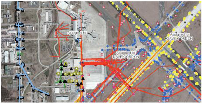
Highways
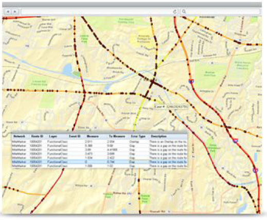 To build a smarter and safer infrastructure G IS can help you plan, monitor, and manage strategic infrastructure
more effectively. Use the location power of your data to determine capacity enhancements, improve operations,
and identify the most strategic investments for maintaining your transportation infrastructure. GIS can make your stand-alone systems work smarter by connecting them.
Use in Path Analysis, Navigation and Allocation of Resources:
The travel time on alternate routes was used to calculate travel time savings gained from construction of the proposed project. An alternative route is based on the identification of the shortest path between end points where the new roads are to be constructed. Path Finding Module of Arc/info can be used to generate the shortest route between points of the proposed project interactively. This can be a done using the link impedance attribute table which contains link’s travel time calculated in GIS based on speed, length and access penalty factors. GIS is used to identify links for projects where Vehicle Miles Traveled (VMT) is used as variable for analysis. Arc identifiers can then be used to join the network links in GIS to the VMT data obtained from the travel model output. And that GIS Roads and Facilities Data used for GPS Vehicle Navigation.
Natural Resource
There is a very vast application of GIS based systems in context of Natural Resource based Industries like those dealing with Agriculture, Conservation, Environmental Management, Forestry, Mining, Oceans, Petroleum and Water Resources.
Forestry
 Forestry is complex, dynamic, and multidimensional. Needs of the forest as well as the pressures of economic efficiency must also be met. GIS technology profoundly and positively impacts the way land managers, timber managers, and forestry specialists manage timber resources. Esri GIS helps understand forest science, economics, and social principles. One will better care for the forest, reach your business objectives, and complete regulatory reporting requirements. Use Esri ArcGIS technology to improve inventory, land administration, sustainable forest planning, timber sales, and more.
Climate, Weather, and Atmosphere
While the earth’s weather patterns are shifting, people are looking for sustainable solutions founded on science. Data, tools, and knowledge come together in GIS to help clearly understand the geography of climate and predict change. Use the powerful GIS based platforms to share data, collaborate, and communicate with scientists across the disciplines.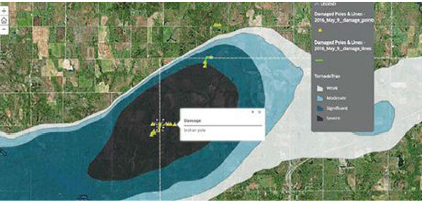
Mining
From mineral exploration to mine remediation, GIS based technologies support decision making throughout the entire mining life cycle. GIS can be used for project planning, mining 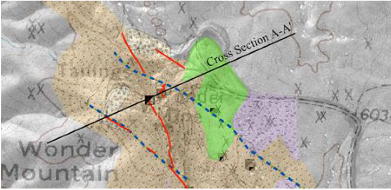 operations, transportation management, and risk
analysis. Don’t miss business opportunities because the information is scattered throughout the company. Use the GIS based platform to bring information together so it can be analyzed in a geographic context, discover new leads, and develop prospects.

